Popular Posts

Tuesday, August 16, 2016

NORSE ARTIFACTS

WHEN the ENGLISH INVADED,
MOST AMERICANS WERE CATHOLICS,
WHO SPOKE NORSE!

NORSE ARTIFACTS
.
Holand collected thirteen (13) 14th century artifacts.   Ten of them are shown below.  He found similar artifacts in the museums of Norway.  These artifacts appear to be ignored by Social Scientists, who write textbooks for early American History.
The Halberts might have come from King Magnus' court, 1355.


There has been little written for kids to read about these Norse artifacts.  
Social Scientists, who ignore Holand, state that these 14th century tools were probably carried to America by 19th century immigrants. 
.
Holand had already written about evidence that made this statement  invalid.  
There are a few modern American communities with higher density of modern Scandinavians, which have not yielded 14th century artifacts. Wausau, Wisconsin is one example.
.
Also the halberds could not be found in Scandinavia.  How could 19th century immigrants 
carry a halberd to America, when that Halberd does not exist in Norway museums?
.
This evidence contributes to the understanding that the Norse were in Wynland of West in the 14th century.  Yet Social Scientists, who do not do their homework, continue to pedal the myth that the poor Scandinavian immigrants, who were lured to America by the railroads, had enough spare luggage room so they could salt the earth of western Minnesota with the best steel tools of the 14th century. 
.
Then there is the whetstone with the steel core, which Steve Hilgren found near Fish Lake in Minnesota in AD 2009.
.
So who do you believe? Holand or most social scientists, who teach Early American History?
.
If your kids, or grandkids, answer that the "Norse were first Europeans to come to America," will their SAT scores earn tthem a scholarship?
.
DISCUSSION
If you believe in the evidence you see, how would you convince thousands of Social Scientists to show the pictures to the kids?
.
[Remember most textbook publishers will rewrite textbooks primarily to sell more.  If the teacher rejects a textbook for any reason, publishers will try to remove the reason.]

WORD


Wednesday, August 10, 2016

LENAPE HISTORY, WHETSTONES

WHETSTONES
Archaeologists, who do research on ancient sites, know that if they find a whetstone, they can be positive that Norse were in the neighborhood.
.
This Whetstone, was found by Steve Hilgren south east of Wynland.
.
.The whetstone shows that Norse were in western Minnesota.  This artifact is evidence that the Norse skulls found by Thomas E. Lee are valid.
. The skulls were carbon dated to AD 1040.
. Thus whetstones found in America may indicate Norse settlements in America dating back one thousand years. 
.
A whetstone, similar to the one Hilgrenn found, was the only artifact found under the Kensington Rune Stone.

A Whetstone similar to this was found near the Kensington Rune Stone. It may have a metal rod inside.
. A comparable whetstone has been found in the Museums in Greenland.
Whetstone found in Greenland
________________

The major Copper Haulers route was south, out of the Christian Sea, up the Nelson River and across Lake Winnipeg.
.
At the south end of Lake Winnipeg the route went three ways. 
.
One way was to Thunder Bay, north of Lake Superior.
.
The second way was south, going up the Red River.
.
The third way was west toward Minot, ND then south to reach the northern bend of the Missouri.
.
If Norse had followed the Copper Route into North America, there should have been whetstones found along the routes.
.
Were there any whetstones found in the Dakotas?
.
The answer is, “None that we know about.”  
.
But South Dakota does have two Whetstone waterways.

The overview shows where they are.  The Whetstone River near Big Stone Lake (north east corner).
.
The Big Stone Lake area would have been a place where Norse may have lived for extended periods.  It is a site with woods, water, and a large body of water near-by.

The Whetstone Creek near Geddes, SD, has similar terrain adjacent to a major water source.
Both Whetstone areas may have been the location of Norse people. 
.
From this location Norse people may  have “discreetly slipped away” and populated eastern North America during the two hundred years before the Little Ice Age.
.
Compare the 200 year span to the 240 years the United States has existed.  There was adequate time for the Norse to populate eastern Norse America.  The evidence shows that they did.
.
When “No one turned back,” the LENAPE may have known their relatives were living in better conditions in areas to the west.

WORD

Wednesday, November 19, 2014

Holands's 1928 drawing of the Viking Waterway.

WHEN the ENGLISH INVADED,
MOST AMERICANS were CATHOLICS
WHO SPOKE NORSE.

.
The Viking Waterway
connected the Red River watershed
to the Mississippi watershed
.
Thus creating a waterway capable of floating
small knarr boats with 
crews fifteen or sixteen men
on a Viking voyage from
the Hudson Bay to the Gulf of Mexico.
.
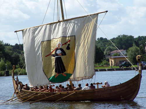
A Viking knarr having 
seven rowers per side
would be an example of the boat
 that traversed America.
.
The map above was made in 1928
by Hjalmar Holand.
It took until 1956 to publish the information
in "Explorers in America Before Columbus."
.
The triangles represent mooring stones.
.
Harbors, most man modified,
are seen via Google Earth
near each mooring stone.
.
A huge number of slaves
(Asia minor and Europe was full of slaves then)
may have been carried in by ship and boats
to modify the natural harbors
to enable the knarr to float on water
from Hudson Bay to the Gulf of Mexico.
.
Myron D Paine, Ph. D. [Engineering]
traced the transcontinental waterway
February 28, 2010 
.

Beginning of the Minnesota waterway passage in 1362

Buffalo River comes from the east.  In spring the waters may be fast.  But notice that the river runs through country that would have been prairie in the 14th century.  A crew of 30 men could have pulled a heavy (Holand estimated 1,500 pounds) longboar upriver.

Possibly there might have been men with pulling ropes on both sides of the river.  The river rises 300 feet in about 90 miles.  The boat may have been pulled, but it was floating on water.  The pulling task may have taken 3 to 5 days.


[Click on photos for a larger view.]

Junction of Buffalo River and Red River

Holand"s Mooring Sones #1, 2, & 3.


     HOLAND'S MOORING STONES #1, 2, & 3.


Holand’s Mooring stones #1. 2. and 3, are shown in this picture as white targets above the white “Z” locators.  Mooring stone #3 is at Duck Lake that is at the highest elevation.  From this lake, near Lake Park, MN, today, the heavy crew-rowed boats could go mostly down stream to the Gulf of Mexico.  The Duck Lake and La Belle Lake have been divided by a road way.  Duck Lake had a streams flowing away toward Buffalo River in the west and La Belle Lake flows  from the east side.  


The cross over from the Red River watershed to the Mississippi watershed occurs further down stream of the water flowing from the east end of La Belle Lake, northeast of Lake Park, MN.

MOORING STONE AND HARBOR #1


MOORING STONE and HARBOR #1


This is the location of mooring stone #1.  Notice that it appears to be a man made lagoon with straight sides and almost square corners.  This is not a natural formation.  In Holand’s time a man made lagoon would have required much work with horses pulling dump buckerts.

There is a possibility that the lagoon was made, for some reason, by modern earth moving equipment.  But when the other mooring stone locations are observed. The paradigm changes.  This small harbor may have been dug into place by humans during the copper trading  era about 3,500 years ago.

This small harbor may have been a rest stop after the long pull up the Buffalo River.  It would hold only about nine longboats.  That may have been enough for a crew to get a day of relaxation before they had to get out of the way of the crews pulling upriver behind them. 

MOORING STONE AND HARBOR #2


MOORING STONE and HARBOR #2
.
Mooring stone #2 location is shown at the center left of this image.  The image is taken from a higher elevation than the image for mooring stone #1.  So the harbor looks smaller but it will hold more longboats.  
.
The earthen berm to the right appears to have been made by someone moving dirt into the lake to form the harbor.
.
STINKING LAKE MOORING STONE
Mooring stone #2 is shown at the left.  This location is just before the pull to Duck Lake where mooring stone #3 was found.   Boat crews may have put into this harbor to prepare while waiting their turn on the boat lift segment.  Maybe additional men with ropes joined the crew, who would soon make the pull up the shallow stream toward the 60 foot lift.
.
The larger stones used for mooring stones may have been moved into place by the Copper miners of 4,200 to 3,200 years ago.
.
An iron bit was needed to make a hole in the mooring stone.  The holes in the stones are evidence that the iron-age Vikings were in western Minnesota from the years 1,000 to 1,400.  Steve Helgrin has found the front edge of a Viking iron bit (2011).
VIKING WATERWAY, STINKING to DUCK LAKE SEGMENT
The image above shows the waterway from Sti1nking Lake, left top, to Duck Lake, right bottom.  This segment was a difficult passage.  The elevation profile at the bottom of the image illustrates the difficulty.
.
Up until this segment the boat crews may have been gaining elevation by walking in the grass and pulling an empty boat upstream.  When they reached Stinking Lake they would have pulled the boat about 43 miles from the Red River.  They would have gained about 380 feet of elevation.
.
The STRAIGHT cut.  Stinking Lake is beyond the trees.
But the Stinking to Duck Lake passage was different.  They could pull a few miles upstream on a small waterway that quickly petered out.  The first segment may have been a marsh.
.
Apparently a large amount of man power was used to straighten a waterway through that maze.
.
Then they were faced with a portage of the boat about sixty feet (60') high.  See the sudden rise at the right of the elevation profile.  
.
This land formation may have been caused when the Big Event. created the Horst of western Minnesota.  The uplifted flat terrain did not create rivers as mountain terrain would.  So the boat crews were faced with lifting the boats over the uplifted edge of Wynland of West. 
.
The DEEP CUT from Sinking Lake to Duck Lake

They may have made the portage easier by investing a great amount of manpower to make this deep cut.     In the Bronze age they may have had literally boat loads of slaves.
.
This cut is 200 feet wide, 1,000 feet long and slopes from the pond in the background to the height of a shallow depression over the ridge line between Stinking Lake and Duck Lake.
Another view of the Deep Cut,
 looking toward Stinking Lake.
.
Notice, in the image to the right, that the cut is about 16 feet deep in the center where the top of a small ridge is seen.  The near edge of the ridge is seen in the bottom of the image.

.
Perhaps the crew, or the slaves, stood on the hills up and over the ridge as they pulled the boats up the deep cut.  The advantage of the cut would have been that, when the men pulled on the ropes, they would have been a lifted the boat as well as moving it up the slope.  Without the cut, which enabled men to be above the boat, they may have pulled the boat down toward the snow or rollers.  The men standing on the edge of the cut would have would have been pulling the boat forward and lightening the weight on the snow or rollers at the same time.
.
The COMPELLING EVIDENCE.
.
The EVIDENCE of the Viking Waterway,
 c3,700 years old, is:
.
The man modified harbor in Stinking Lake.
The mooring stone(s) in Stinking Lake.
The straight cut for 1,000 feet, east of Stinking Lake.
The deep cut of 1,000 feet long, 200 feet wide, and 16 feet deep in the best location to provide the best portage from the shallow stream to Duck Lake.
The man modified berms creating a harbor at Duck Lake.
The mooring stone at Duck Lake. 
[Reported by Holand in 1928. Now apparently covered by the road.]
.
The EVIDENCE for the Viking use of the waterway is:
.
The holes in the mooring stones.
The 14th century Norse artifacts found at the Buffalo River.
The Viking Sword. (Ulen Museum)
The Bronze spear point with founder's marks (in Mahnonmen museum).
The two arrows with metal arrowheads.  (Detroit Lakes Museum).
The Kensington Rune Stone. (Alexandria Museum)
The many 14th century Norse artifacts in the Alexandrea Museum.
The Viking whetstones. (Alexandria Museum and Steve Helgrin).